LSU Receives Grant from Coypu Foundation to Restore Rare Louisiana Maps
A generous $20,000 grant from the Coypu Foundation will allow LSU Libraries’ Special Collections to professionally restore two rare, early nineteenth-century maps.
John La Tourrette’s Reference Map of the State of Louisiana (1845) and Catesby Graham’s Map of the State of Louisiana on an Enlarged and Improved Plan (1838) are significant cartographic works that provide invaluable historical insights into the state's geography, settlement patterns, and land use during the 1800s.
“Both maps set themselves up against two rather difficult problems,” said John Miles, Special Collections’ Curator of Books and Head of Instruction. “On one hand, the need to accurately represent the notoriously mutable land and waterways of Louisiana using the surveying equipment available at the time, as well as the technical difficulties of engraving and reproducing a large-format map — a highly specialized skill at the time.”
Each map is rich in detailed geographic data and is also visually striking, featuring hand-coloring and artistic embellishments that depict the state’s early geography. To do so, both maps are large: La Tourrette’s map is roughly four and a half feet wide and four feet tall, while Graham's is almost five feet wide and a whopping six feet tall.
“While this large format allows for a surprising level of geographic detail, it does pose problems for conservation, as working with such large, fragile, multi-sheet maps is ungainly and difficult. As the maps close in on two centuries of use, it is well time for some professional attention,” Miles said.
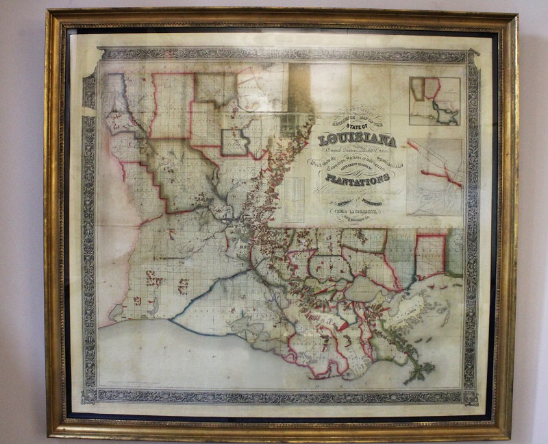
La Tourrette’s Reference Map of the State of Louisiana (1845) features early plots of newly established parishes and detailed depictions of plantations throughout the state, providing a unique glimpse into Louisiana’s development at that time.
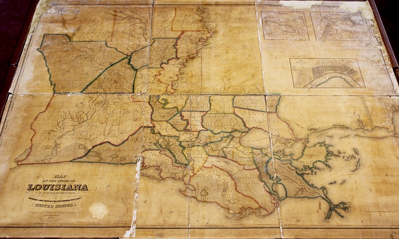
Catesby Graham’s Map of the State of Louisiana on an Enlarged and Improved Plan (1838) is a hand-colored, highly detailed map. Currently divided into six separate sheets, this map is difficult to use and display in its current state.
“Because both are so rare, and because they both contain a level of geographic detail not available on any other maps from this period, we thought they were ideal candidates for professional restoration,” said John Miles, Special Collections’ Curator of Books and Head of Instruction. “Given the Coypu Foundation's dedication to preserving the natural history of Louisiana and the Gulf Coast, we thought they would be ideal partners in this endeavor.”
The Coypu Foundation supports research related to wildlife ecology and was established by John Stauffer (“Jack”) McIlhenny (1909-1997) upon his death. His dedication to LSU and the sciences is memorialized by Special Collections' E. A. McIlhenny Natural History Collection, given in honor of Jack’s uncle, Edward Avery (1872-1949).
Once restored, both maps will be available to the public in Special Collections’ reading room. For more information about LSU Libraries Special Collections, visit lib.lsu.edu/special.